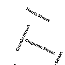
12 BOLTON RD
Owner Information
KOUMBIS ROBERT
12 BOLTON RD
CLINTON, MA 01510


Property Details
12 BOLTON RD is classified as a Single Family Residential (Colonial).
The primary structure on this property was built in 2007. There are 4,180ft2 of built area within this property. There is 2,528ft2 of residential/living space within this property. This property is listed as having 8 rooms.
12 BOLTON RD is valued at $511,500. The land is valued at $98,800 and the structures are valued at $409,600. There is an additional valuation of $3,100 on this property.
This property is in Zone R2. Confirm with local Zoning Board authorities to ensure there are no overlays or other easements on this property.
The most recent deed for 12 BOLTON RD is recorded at the local registrar in Book 59882, Page 0072. 12 BOLTON RD was last sold on Friday, December 28, 2018 for $399,000.
Assessment data from fiscal year 2022.
Flood Data
According to the FEMA National Flood Hazard Layer, this property does not appear to be in a flood zone. It may also be in an area not yet reviewed. Nonetheless, confirm this information prior to taking any action.
To view the flood hazards around this property, create a FEMA "Firmette" Map of the area around 12 BOLTON RD.
Broadband Internet Providers
| Provider | Type | Bandwidth (mbps) | |
|---|---|---|---|
| Comcast | Cable | 1000 | 35 |
| Verizon New England Inc. | DSL | 10 | 1 |
| Viasat Inc | Satellite | 100 | 3 |
| GCI Communication Corp. | Satellite | 0 | 0 |
| VSAT Systems, LLC. | Satellite | 2 | 1 |
| HughesNet | Satellite | 25 | 3 |
Broadband service provider data from December 2020.
Adjacent Properties
- 10 BOLTON RD
Single Family Residential owned by HAMMOND PATRICIA - 14 BOLTON RD
Developable Residential Land owned by CROWELL, STANLEY - 28 BOLTON RD
Single Family Residential owned by PULNIK JOHN M - 22 HARRIS ST
Single Family Residential owned by CIESLUK CAMERON G - 26 HARRIS ST
Single Family Residential owned by LINTON DANIEL L JR - 20 HARRIS ST
Single Family Residential owned by CANDICE REYNOLDS